4 min to read
Accurate and Robust Propogators and Gradients for Land Seismic Imaging
Immersed Boundary Method in Finite-Differences for Accurate Land-Air Boundary Conditions
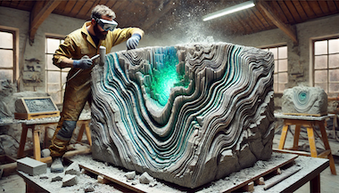
At Devito Codes, we continue to push the boundaries of seismic imaging and wave propagation. Our latest innovation, to be showcased at IMAGE’24, addresses one of the most challenging aspects of land seismic imaging: accurately modeling wavefields in the presence of complex topography using finite-difference methods, all without the need for unstructured mesh generation.
Imaging from Topography
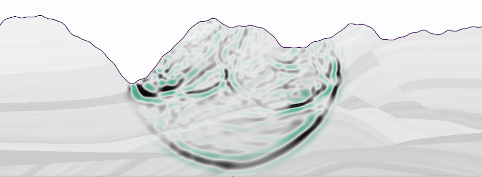
High-quality topography handling enables calculation of accurate gradients and FWI topographic updates, even in settings where topographic variation is extreme. If forward and adjoint modeling can capture the physics of the free-surface, these effects become data rather than noise; leveraging this data enhances resolution and illumination, whilst minimizing the requisite preprocessing and streamlining imaging workflows. However, failure to accurately account for the effects of topographic variation leads to images which are unfocused and artefact-prone at best, and entirely incoherent at worst. It follows that for confident and robust land seismic imaging, accurate topography implementation is crucial.
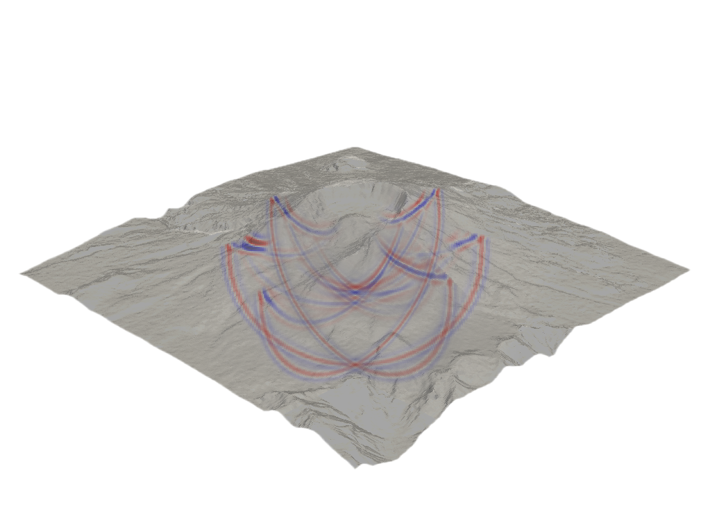
Illumination-corrected gradient for an FWI tomographic update
Corresponding inverse-scattering imaging condition
Understanding the Challenge
Traditionally, incorporating topography into solvers has been a complex and time-consuming task, often requiring the development of bespoke solutions that are difficult to generalize across different wave equations. While finite-element methods and mesh generation offer potential solutions, they come with significant challenges, including a lack of software and practical experience in developing finite-element inversion methods for exploration geophysics and the absence of robust automatic mesh generation techniques. These factors make finite-element approaches less attractive for building efficient seismic imaging processing pipelines, further complicating the incorporation of complex topography for land seismic imaging.
A General Approach to Modelling Complex Topography
To solve this problem, we’ve developed Schism, a module that automatically generates immersed-boundary operators for Devito. Schism simplifies the integration of complex topographies into wave propagation models, separating topography specification from numerical implementation. This allows imaging algorithms to leverage sophisticated topography handling routines without added complexity.
Immersed boundaries represent free surfaces as sharp interfaces on a regular grid, accurately reflecting the true surface position. This method eliminates the need for mesh generation or curvilinear grids, by constructing suitable field extensions beyond the boundary, which are incorporated into surface-adjacent FD operators, enforcing the necessary boundary conditions.
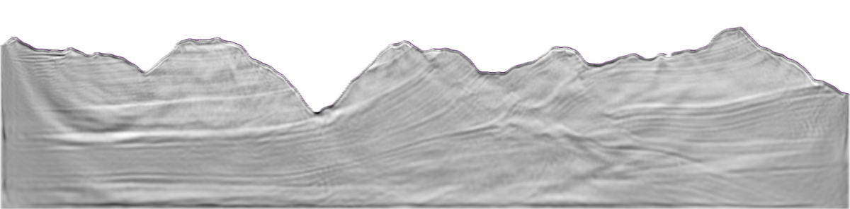
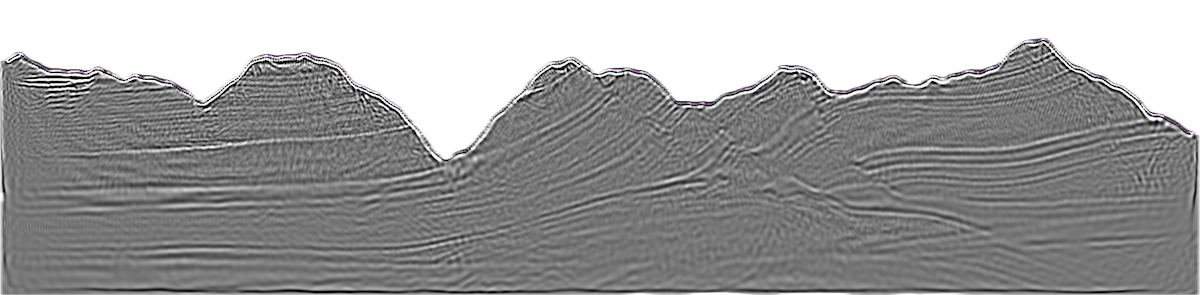
Our paper, A Novel Immersed Boundary Approach for Irregular Topography with Acoustic Wave Equations, published earlier this year in Geophysics, demonstrates this approach by modeling wave propagation around the complex topography of Mount St. Helens.
As illustrated below, the 3D free-surface wavefield is accurately rendered, capturing the intricate interactions of the wavefield with steep, uneven terrain. This showcases the power of the immersed boundary method in addressing real-world seismic challenges.
Applying to Land Seismic Data
We are collaborating with service companies like S-Cube to apply these methods to real-world land seismic applications. Accurately modeling acoustic and elastic TTI wavefield behavior in environments with pronounced and irregular topography is essential. Our immersed boundary method effectively captures topographic effects such as surface multiples, amplitude variations, and diffraction around obstacles while maintaining the regular computational grids commonly used in imaging applications. This makes it an ideal choice for integrating topography handling into existing solvers and imaging workflows.
The innovation here lies in the robustness and generality of the approach, allowing integration into existing seismic data processing pipelines. The boundary treatment is tied to the discretization, boundary conditions, and geometry but not to the governing equations. Through symbolic computation and a generalized mathematical approach, immersed boundary treatments can be generated for various equations and boundary conditions, ensuring flexibility and ease of use. For example, higher-order free surface conditions derived from isotropic acoustic wave equations behave similarly in acoustic TTI contexts, offering a computationally efficient alternative.
Join Us at IMAGE’24
Our immersed boundary support is now available as an experimental feature in DevitoPRO. If you are interested in learning more about Schism, Devito, or DevitoPRO, we invite you to go and see Dr. Ed Caunt at his IMAGE’24 presentations:
Wednesday 28/08 10:00
S-Cube & Devito Codes: New Developments for Advanced Physics, S-Cube & ThinkOnward Booth (1659) in the Digitalisation Pavillion.
Thursday 29/08 08:00-09:40AM
Recent Advances in Seismic Modeling 1, (Session ID: SMT P1) Poster Station 3 (3rd Level) A, in the George R. Brown Convention Center
- An immersed boundary topography approach for TTI acoustic propagation
- Towards elastic-free surface topography with immersed boundaries